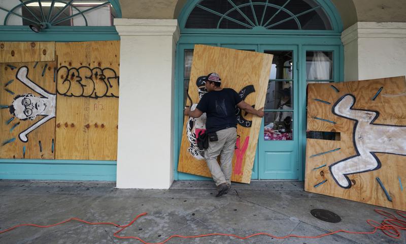
NEW ORLEANS (AP) — Forecasters warned residents along the northern Gulf of Mexico coast to rush preparations Saturday ahead of an intensifying Hurricane Ida, which is expected to bring winds as high as 130 mph (209 kph), life-threatening storm surge and flooding rain when it slams ashore in Louisiana on Sunday.
The National Hurricane Center warned that super-warm Gulf waters could rapidly magnify Ida’s destructive power, boosting it from a Category 2 storm to an extremely dangerous Category 4 hurricane in just 18 hours or less.
Coastal highways saw heavy traffic Saturday as people moved to escape the storm’s path. Trucks pulling saltwater fishing boats and campers streamed away from the coast Interstate 65 in south Alabama. Traffic jams clogged Interstate 10 heading out of New Orleans.
Ida was poised to strike Louisiana 16 years to the day after Hurricane Katrina devastated the Mississippi and Louisiana coasts. A Category 3 storm, Katrina was blamed for 1,800 deaths and caused levee breaches and catastrophic flooding in New Orleans, which took years to recover.
“We’re not the same state we were 16 years ago,” Louisiana Gov. John Bel Edwards said Saturday, pointing to a federal levee system that’s seen major improvements since Katrina swamped New Orleans in 2005.
“This system is going to be tested,” Edwards said. “The people of Louisiana are going to be tested. But we are resilient and tough people. And we’re going to get through this.”
Edwards said 5,000 National Guard troops were being staged in 14 parishes for search and rescue efforts with high-water vehicles, boats and helicopters. And 10,000 linemen were on standby to respond to electrical outages.
A tropical depression two days earlier, Ida was strengthening so quickly that New Orleans officials said there was no time to organize a mandatory evacuation of the city’s 390,000 residents, a task that would require coordinating with the state and neighboring locales to turn highways into one-way routes away from the city.
New Orleans Mayor LaToya Cantrell called for a voluntary evacuation and reiterated Saturday that the time to safely leave was growing short. Collin Arnold, the city’s emergency management director, said the city could be under high winds for about 10 hours. Officials warned those who stayed to be prepared for long power outages amid sweltering heat in the days ahead.
“That said, if we see 10 to 20 inches of rain over an abbreviated period of time, we will see flooding,” he said.
In Washington, President Joe Biden on Saturday called Ida “very dangerous” and urged Americans “to pay attention and be prepared.”
Lines at gas pumps and car rental agencies grew long as residents and tourists alike prepared to leave Saturday.
“We were willing to wait it out but the hotel said we had to leave,” said visitor Lays Lafaurie of Fort Worth, Texas, waiting in a rental car line at the city’s airport. “They said we had to leave by 7 tomorrow morning. But if we’d waited that long there wouldn’t have been any cars left.”
Ida posed a threat far beyond New Orleans. A hurricane warning was issued for nearly 200 miles (320 kilometers) of Louisiana’s coastline, from Intracoastal City south of Lafayette to the Mississippi state line. A tropical storm warning was extended to the Alabama-Florida line, and Mobile Bay in Alabama was under a storm surge watch.
Alabama Gov. Kay Ivey declared a state of emergency Saturday for the state’s coastal and western counties, warning Ida could bring flooding and tornadoes there.
In Mississippi, Gov. Tate Reeves urged residents to stay off of interstate highways to make room for people fleeing Louisiana. He said 19 shelters had opened to take in evacuees. Several casinos on the Mississippi coast had closed ahead of Ida.
Meteorologist Jeff Masters, who flew hurricane missions for the government and founded Weather Underground, said Ida is forecast to move through “the just absolute worst place for a hurricane.”
The Interstate 10 corridor between New Orleans and Baton Rouge is a critical hub of the nation’s petrochemical industry, lined with oil refineries, natural gas terminals and chemical manufacturing plants. Entergy, Louisiana’s major electricity provider, operates two nuclear power plants along the Mississippi River.
A U.S. Energy Department map of oil and gas infrastructure shows scores of low-lying sites in the storm’s projected path that are listed as potentially vulnerable to flooding. Phillips 66 said it was shutting operations at its refinery in Belle Chasse, Louisiana.
Many gas stations in and around New Orleans were out of gas, and the few still open had lines more than a dozen cars deep.
Mike Laurent of Marrero, Louisiana, was filling up about a dozen gas canisters to fuel his generator and those of friends and family. Laurent said his family planned to weather the storm at home despite concerns about whether the nearby levee would hold.
“I don’t think it’s ever been tested like it’s going to be tested tomorrow or Monday,” Laurent said. “I bought a dozen life jackets, just in case.”
By Saturday afternoon, Ida was a Category 2 hurricane with maximum sustained winds of 105 mph (168 kph) . The storm was centered about 325 miles (525 kilometers) southeast of coastal Houma, Louisiana, and was traveling northwest at 16 mph (26 kph).
Cuba started to clean up Saturday after Ida tore through Isla de la Juventud and then western parts of the mainland. The storm toppled trees and damaged crops and buildings. There were no reported deaths.