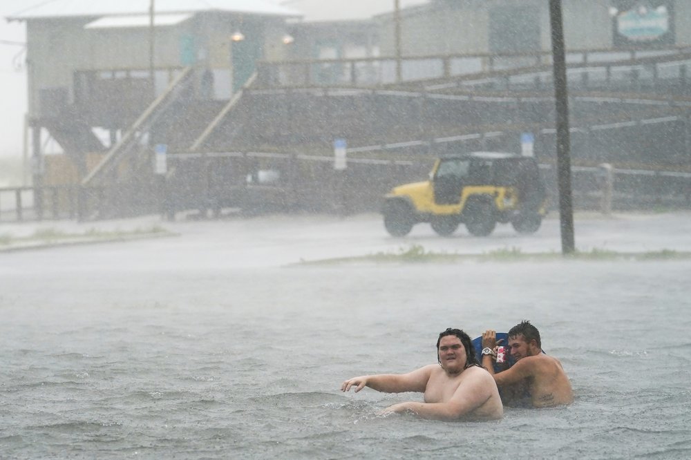
PENSACOLA, Fla. (AP) — Hurricane Sally made landfall Wednesday near Gulf Shores, Alabama, as a Category 2 storm, pushing a surge of ocean water onto the coast and dumping torrential rain that forecasters said would cause dangerous flooding from the Florida Panhandle to Mississippi and well inland in the days ahead.
Moving at an agonizingly slow 3 mph, Sally finally came ashore at 4:45 a.m. local time with top winds of 105 mph (165 kmh), the National Hurricane Center said. Sally’s northern eyewall had raked the Gulf Coast with hurricane-force winds and rain from Pensacola Beach, Florida, westward to Dauphin Island, Alabama, for hours before its center finally hit land.
Trees were bending over and flailing around in the howling winds in downtown Pensacola, where driving rain flooded streets up to the bumpers of parked cars. In downtown Mobile, Alabama, a street light snapped, swinging wildly on its cable.
Nearly 400,000 homes and businesses had lost electricity by early Wednesday, according to the poweroutage.us site. A curfew was called in Gulf Shores due to life-threatening conditions. In the Panhandle’s Escambia County, Chief Sheriff’s Deputy Chip Simmons vowed to keep deputies out helping residents as long as physically possible. The county includes Pensacola, one of the largest cities on the Gulf Coast.
“The sheriff’s office will be there until we can no longer safely be out there, and then and only then will we pull our deputies in,” Simmons said at a storm briefing late Tuesday.
This for a storm that, during the weekend, appeared to be headed for New Orleans. “Obviously this shows what we’ve known for a long time with storms – they are unpredictable,” Pensacola Mayor Grover Robinson IV said.
Stacy Stewart, a senior specialist with the hurricane center, told The Associated Press said the rainfall will be “catastrophic and life threatening” over portions of the Gulf Coast, Florida panhandle and southeastern Alabama, and will continue well after landfall, with the storm producing heavy rainfall Wednesday night and Thursday over portions of central and southern Georgia.
Sally was a rare storm that could make history, said Ed Rappaport, deputy director of the hurricane center.
“Sally has a characteristic that isn’t often seen and that’s a slow forward speed and that’s going to exacerbate the flooding,” Rappaport told the AP.
He likened the storm’s slow progression to that of Hurricane Harvey, which swamped Houston in 2017. Up to 30 inches (76 centimeters) of rain could fall in some spots, and “that would be record-setting in some locations,” Rappaport said in an interview Tuesday night.
Sally’s impact was felt all along the northern Gulf Coast. Low lying properties in southeast Louisiana were swamped by the surge. Water covered Mississippi beaches and parts of the highway that runs parallel to them. Two large casino boats broke loose from a dock where they were undergoing construction work in Alabama.
In Orange Beach, Alabama, Chris Parks, a tourist from Nashua, New Hampshire, spent the night monitoring the storm and taking care of his infant child as strong winds battered his family’s hotel room. Their return flight home was canceled, so they were stuck in Alabama until Friday.
“I’m just glad we are together,” Parks said. “The wind is crazy. You can hear solid heavy objects blowing through the air and hitting the building.”
Mississippi Gov. Tate Reeves urged people in the southern part of his state to prepare for flash flooding.
As Sally’s outer bands reached the Gulf Coast, the manager of an alligator ranch in Moss Point, Mississippi, was hoping he wouldn’t see a repeat of what happened at the gator farm in 2005, when about 250 alligators escaped their enclosures during Hurricane Katrina’s storm surge.
Gulf Coast Gator Ranch & Tours Manager Tim Parker says Sally has been a stressful storm because forecasters were predicting a storm surge of as much as 9 feet in his area. He felt some relief after surge predictions shifted.
Sally was forecast to bring heavy downpours to parts of Mississippi, Alabama, Georgia and the Carolinas later in the week. Some inland residents weren’t waiting, driving to the coast to experience Sally’s power before it hit land.
With heavy rains pelting Navarre Beach, Fla., and the wind-whipped surf pounding, a steady stream of people walked down the wooden boardwalk at a park for a look at the scene Tuesday afternoon.
Rebecca Studstill, who lives inland, was wary of staying too long, noting that police close bridges once the wind and water get too high. With Hurricane Sally expected to dump rain for days, the problem could be worse than normal, she said.
“Just hunkering down would probably be the best thing for folks out here,” she said.
Meanwhile, Tropical Storm Teddy has now become a hurricane with maximum sustained winds of 100 mph (160 kph) the National Hurricane Center said early Wednesday.
Teddy is located about 820 miles (1,335 km) east of the Lesser Antilles. Hurricane-force winds extend outward up to 25 miles (40 km) from the center and tropical-storm-force winds extend outward up to 175 miles (281 km).
Some strengthening is forecast during the next few days, and Teddy is likely to become a major hurricane later Wednesday and could reach Category 4 strength on Thursday.